


Decorative Maps
We take pride in creating illustrated property maps that truly capture the character of your country estate or farm. Whether you manage a family shoot or a sprawling grouse moor, our award-winning maps bring your property to life with remarkable detail and artistry.
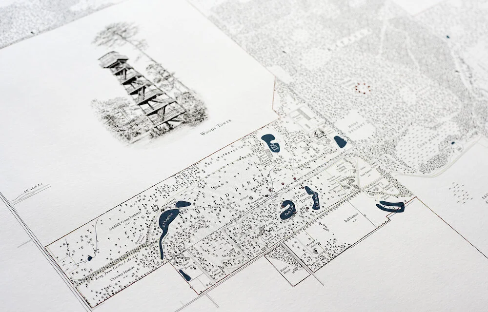
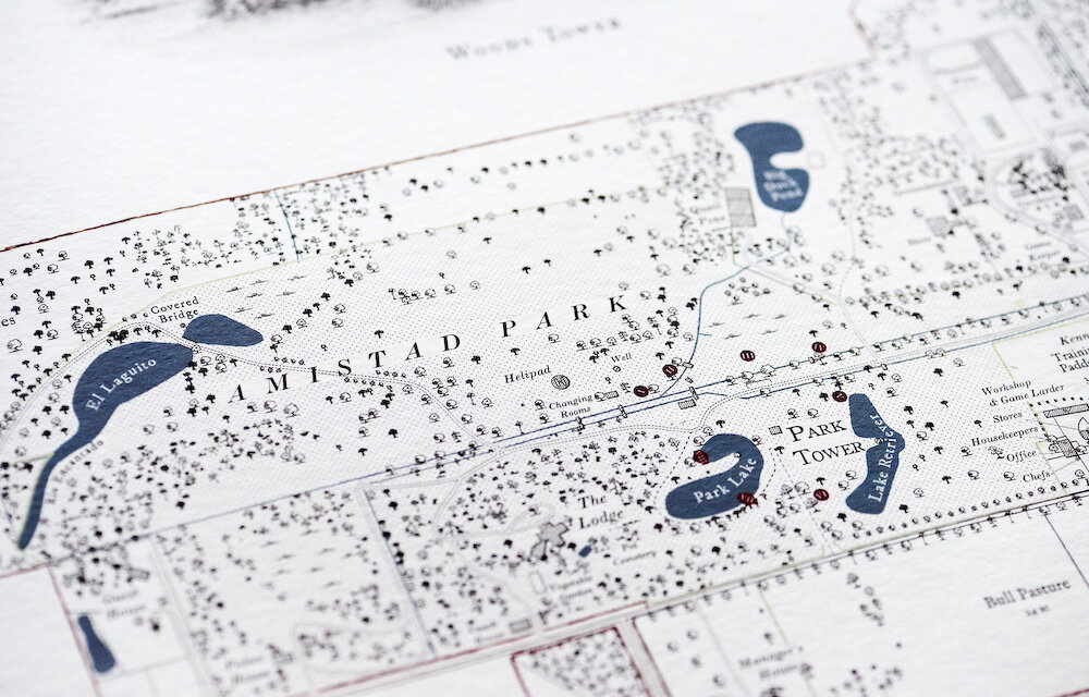
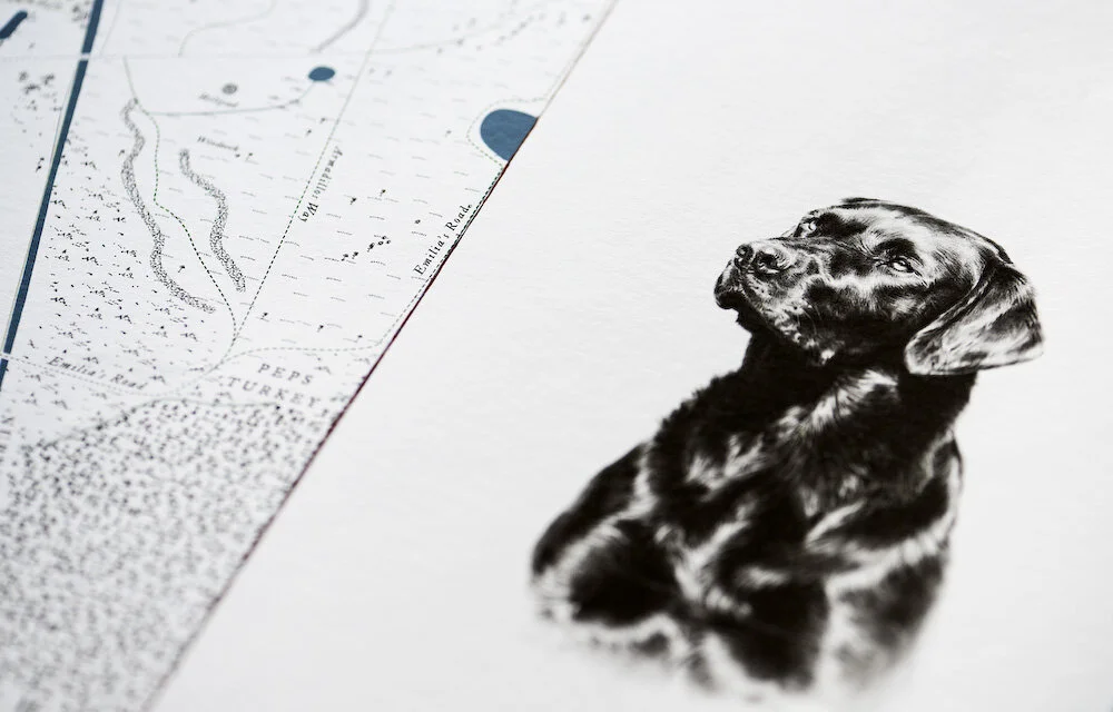
Crafted with meticulous attention to accuracy, the maps showcase every aspect of your land. Each piece features hand drawn illustrations that highlight your property’s unique features, from traditional hunting scenes and local wildlife to distinctive architectural details.
Drawing inspiration from the elegance of 19th-century estate maps, our designs often include intricate coats of arms, and ornate cartouches.
Printed in large formats, these maps are perfect for framing and displaying as a statement piece in your home or office. Each map is more than just a depiction of your land; it’s a celebration of your heritage and lifestyle.
To discover more about commissioning your bespoke decorative map, please visit our process page.
“Maps commissioned by country estates are valuable historical records as well as being aesthetic objects”
“Producing some of the finest bespoke maps today. They would look the part in shoot lodges, farm offices and drawing rooms across the world.”
Features
Field & Woodland boundaries
Given names and sizes.
Table of field names, sizes & total area
Buildings, routes and natural features
Individual in-field trees and hedgerows
Contour lines
Ownership/Property boundary
County/Parish boundary
Title block
Available on request
Illustrations - views and vignettes, game scenes, wildlife
Family crest / coat of arms / monogram
Vineyards
Archeological records / finds
Family / animal burial sites
Boundary markers; cairns, posts, trees etc.
Rented land
Please feel free to contact us requesting a physical sample draft to be posted to you.
Prints
Giclee, archive quality printing on heavyweight fine art paper.
Shooting / Sporting Maps
For maps with shoot drives, please see our ‘Sporting Maps’ page.